Friday, 22 July 2016

KANNUR - tHE lAND oF LOOMS , LORES & THEYYAM


KANNUR LAND OF THEYYAMS

tHE lAND oF LOOMS , LORES & THEYYAM


Kannur , formerly known as Cannanore, is a city and a Municipal Corporation in Kannur district, state of Kerala, India. It is the administrative headquarters of the Kannur District and situated 518 km north of the state capital Thiruvananthapuram. During British rule in India, Kannur was known as Cannanore, which is used now only by the Indian Railways. It is the largest city of the North Malabar region.

Kannur district is known as the land of Looms and Lores, because of the loom industries functioning in the district and ritualistic folk arts held in temples. Kannur is famous for its pristine beaches, Theyyam, its native performing art, and its handloom industry. Kannur is of great strategic military importance. Kannur Cantonment is one of the 62 military cantonments in the country and is the headquarters of the Defence Security Corps and Territorial Army’s 122 Infantry Battalion (under Madras Regiment). Ezhimala Naval Academy (INS) is 35 km north of Kannur City. It is Asia's largest and the world's third largest naval academy. An Indian Coast Guard Academy is approved to be built at Kannur. This academy will be built on the banks of Valapattanam River at Irinave, east of Azhikkal. Kannur Cantonment is one of the important cantonments in India.


പല കളിത്തൊട്ടിലായ തെയ്യം, കണ്ണൂര് എന്നീ നിറപ്പകിട്ടാർന്ന നാടോടി കലാരൂപങ്ങളും ആരുടെ അഷ്ടമുടിക്കായലിന്റെ ശലോമോൻ രാജാവിന്റെ കപ്പലുകൾ യെരൂശലേമിന്റെ വലിയ മന്ദിരം പണിയും മരവും ശേഖരിച്ച നിന്ന്, പുരാതന തുറമുഖം പറയപ്പെടുന്നു.  പോലും ഗ്രീക്കുകാർ, റോമാക്കാർ ആൻഡ് അറബികൾ, കണ്ണൂർ വ്യാപാരം കണ്ണികൾ തിരികെ ഒരു നീണ്ട പോകുന്നു. സുഗന്ധവ്യഞ്ജന വ്യാപാരത്തിന്റെ വലിയ എംപോറിയം ആഘോഷിക്കുന്നത് സഞ്ചാരി മാർക്കോ പോളോ വഴി പ്രശംസിക്കപ്പെട്ടിട്ടുണ്ട് ഈ സ്വഭാവം സമ്പുഷ്ടമായ ദേശം സംസ്ഥാന സാംസ്കാരിക, മത, രാഷ്ട്രീയ, വ്യാവസായിക അവകാശത്തെ ഒരു കീ സമ്പാദകർ ഉണ്ടായിട്ടുണ്ട്. . പടിഞ്ഞാറ് കിഴക്ക് പശ്ചിമഘട്ട, ലക്ഷദ്വീപ് സീ അതിരുകള്, കണ്ണൂർ പുരാതന കോട്ടകളും, പഴയ ആരാധനാലയങ്ങൾ അതിന്റെ മനോഹരമായ പ്രകൃതിദൃശ്യങ്ങളും ഡോട്ട് ആഗസ്റ്റ് സാംസ്കാരിക വിദ്യാഭ്യാസ സ്ഥാപനങ്ങളിൽ അതിന്റെ ശ്രദ്ധേയമായ ചരിത്രം പ്രദർശിപ്പിക്കുന്നു .

Ezhimala Hill

Ezhimala (also known as Ezhimalai), a hill reaching a height of 286 metres, is located near Payyanur, in Kannur District of Kerala, South India. As the former capital of the ancient Mushika Kingdom, it is considered to be an important historical site, and is a conspicuous and isolated cluster of hills, forming a promontory, 38 km north of Kannur Town. A flourishing seaport and center of trade around the beginning of the Common Era, it was also one of the major battlefields of the Chola-Chera Wars, in the 11th century. It is believed by some that Lord Buddha had visited Ezhimala. The hill was once known as Mount Delly by the English or Monte D'Ely by the Portuguese

Ezhimala, which is part of Ramanthali panchayath, is one of the most important places in the recorded history of North Kerala. From before the period of known history, some chapters of the Ramayana and local Hindu legends associate the Ezhimala Hills with the famous epic, in particular with Lord Hanuman.
Ezhimala, Pazhayangadi, and several villages and towns in this region find plenty of mention in the extant Tamil Sangam Period's literature (500 BC to 300 AD). Pazhayangadi is the present corrupted form of its ancient name of Pazhi. Pazhi is mentioned as the ancient capital of King Udayan Venmon Nannan (known as Nannan or Nandan) of the Mushika or Kolathiri Royal Family. Though the Dynasty of Nannans was a cousin or sister dynasty of the Cheras and Pandyas and Cholas, warfare among them was nearly consistent, and the period of Nannan was no exception. There are texts that speak of Nannan fighting heroic battles at Pazhi against the Chera Kings who invaded his kingdom (Kolathunadu). Eventually, Nannan was killed in battle by the Chera king, Narmudi Cheral. Like the other kings of the then Tamilakam cultural polity, Narmudi Cheral was a great patron of scholars and poets, and he once gifted his court-poet, Kappiyattu Kappiyanar with 40 lakhs gold coins, as a token of his poetic genius.
Extant Tamil Sangam texts describe the glory and wealth of the ancient Pazhi in the highest terms.Sangam Era poets, as well as Classical Tamil poets of later centuries, like Paranar speak of the wealth of Pazhi in the greatest degree. One of the Sangam pieces, Akam 173 speaks of "Nannan's great mountain slopes where gold fields abound, and long bamboos dried in the Sun burst and released the unfinished pearls." Noted scholar, Elamkulam Kunjan Pillai states that "It is from Kottayam (of North Malabar) and Cannanore regions of old Ezhimalainad that innumerable Roman (gold) coins have been excavated. On one (single) occasion (gold) coins that could be carried by six porters were obtained. These coins were found to belong to the period down to 491 AD"
Ezhimala was also a flourishing seaport and center of trade at least by the start of the Common Era; and later was also one of the major battlefields of the series of Chola-Chera Wars in the 11th century; some believe that Lord Buddha had visited Ezhimala.
Mooshika Vamsham, written by Athulan in the 11th century, throws light on the recorded past of the Mushika Royal Family up until that point. The first recorded king of Mooshika Vamsham (the Mooshika Dynasty) was Ramaghata Mooshika and his capital most probably was Pazhi (ancient Pazhayangadi). Athulan describes the later kings of this dynasty who are now better known as the Kolathiri Dynasty. King Ramaghata Mooshika's successors shifted their capital to Ezhimala, Valabhapattanam (Valapattanam), and eventually Chirakkal, among other nearby places, over the following centuries.


 AARALAM WILDLIFE SANCTUARY 


The Aaralam Wildlife Sanctuary is Kerala's northernmost sanctuary in Kannur District. Its massive evergreen trees sprawl over 55 square kilometers, making it a part of the Northern Wildlife Circle. With headquarters in Iritty, it is centered around Aaralam (Aralam), Thalaseery. This village is noted for the 3060-hectare Central State Farm and its production of hybrid coconut seeds. The sanctuary was established back in the mid 1980's on the western slopes of the luscious Western Ghats. Aaralam, Kottiyoor and Kelakam are the nearest towns and Cheenkannippuzha is the main water source. A majority of the sanctuary's landscape is rugged with hills that are continuous with the forests of Coorg (Kodagu) in Karnataka. Aaralam is an ideal marriage of dense jungle and rocks. This beautiful hill forest land has altitudes that range from 60 meters at the base to Katti Betta, the tallest peak at 1489 msl. Eco-tourism plays an instrumental role in all the activities that take place in Aaralam. Quite apart from the 20 kilometer trek that begins at the mouth of the sanctuary and ends in Ambalapaara, other options such as trekking to Meenmutty and a day visit to Aaralam Sanctuary are on offer. All necessary equipment for camping and trekking is made available. While trekking through Aaralam you move through a variety of forest types. You have West Coast semi-evergreen, West Coast tropical evergreen, Southern hilltop evergreen and South Indian moist deciduous forests. Along with these, Aaralam has 500 hectares of eucalyptus and teak that Kerala is so popularly known for. Aaralam is situated in the extreme north of the state. Its vegetation can be distinctly divided into three strata. Until two thirds of the way up (in terms of altitude) are heavy, cylindrical trees that have not branched out but instead formed an umbrella shaped canopy over itself. The middle stratum comprises conical trees shaped almost like a melting candle. All of Aaralam's trees are ridden with moss and orchids; even lichens and fungi are a regular sight. The wild animals and birds of the sanctuary are typical to the Western Ghats. One can spot wild boar, Malabar giant squirrel, leopards, mouse deer, gaur, sambar deer, Hanuman langur and more. The soil, trees, nooks and corners of the Aaralam Wildlife Sanctuary house several species of amphibians and reptiles as well, including the royal king cobra. There is huge potential for bird watching as you stand in the presence of 188 bird species, a dozen of which are endemic to the region. Keep an eye out for Malabar pied hornbill, Nilgiri wood pigeon, Broad billed roller, Ceylon frogmouth and the great pied hornbill. Rare sightings of the Kerala laughing thrush have been reported too. The sanctuary's aquafuana thrives well and boasts of the endangered Tor Khudree.
The season to visit Aaralam Wildlife Sanctuary would be between October and June; avoid the extreme summer and winter months. Regardless of climate though, if you are a butterfly lover, make sure you visit in November or December to see more than 170 types of the fluttering beauties.
Once at Aaralam, you cannot miss trekking out to Meenmutty Falls. They tumble down from a height of 300 meters in three tiers. The 2-kilometer trail to the falls are rather difficult and can be tiring for the first time trekker, but these virgin falls are fresh and one of the few in the country that are not tainted by commercial tourism.

Paithalmala 

Paithalmala (Malayalam: പൈതൽമല) or Paithalmala is a hill station in the Kannur district of Kerala in India. Located near Pottenplave village, at a height of 1371.6 m above sea level, this is the highest geographic peak in Kannur. It is located at 40 km from Taliparamba and 65 km from Kannur. Nestled in the Kerala Karnataka border near to Kodagu forests, it lies in the Western Ghats. It has become a favourite spot for the nature enthusiasts, photographers, trekkers and leisurely visitors.

There are two trekking seasons at Paithalmala, falling in monsoon and summer. Monsoon (June to October) trekking to Paithalmala is a photographer's delight as the mist blankets the hills and forest. One can indulge into the lush greenery amidst the showers throughout the day, especially in July. Practically, trekking is not as easy as in the summer because of the extreme climate. Watch out for leeches and occasional elephant visits.
Monsoon is followed by a cool climate in Paithalmala and the grass surrounding the hills grow to their fullest size, making it difficult to walk through. As they grow above seven feet, finding the regular way becomes a difficult task. By December, the forest caretakers set fire to the grass, taking care of the rest of the forest, to ease out the trekking experience. Soon after this, the hill becomes unsuitable to trek because of the black sooth formed but clears away after a couple of weeks. The best time for a trek is from Jan to March though the sun might be harsh.
There is an observatory tower made by the department of tourism at the hilltop which can be reached after a 45 min walk from the Paithal valley. Trekking starts through the dense forest followed by the plain grass land on the hill top.
View of the valley from the observatory tower is breathtaking and the observer’s eyes can hover over more than half the area of Kannur district.
Most of the visitors end their trek having time spent around the tower, but much of the excitement of the Paithalmala is located elsewhere.
The best part of the trek is the walk from the observatory tower to the thick forest where trail from Kappimala ends. One can move on top of the hills enjoying the mesmerizing scenery of the Coorg forest on right and Paithal valley on the left. The grassland looks stunning here and arguably is the best scene of the trek. The best time to start the trek is early morning, after the breakfast from the valley and finishing by evening. Lunch, water and snacks need to be carried.
This is one of the few places in Kerala where the nature is not largely affected by human invasion, thanks to the limited reachability. But the future does not look promising because of the increasing tendency of visitors to make it as a drinking spot. The observatory tower is in a poor condition as the walls and barricades are broken or destroyed. The surroundings of the tower are littered with beer bottles and like any other tourist spots, plastic is the major threat here too. It is sad to see even the streams where you get the purest of water have been treated badly with plastic covers thrown around. Nevertheless, the hill top remains largely non-polluted and the visitors are advised to preserve it.


BEACHS IN KANNUR

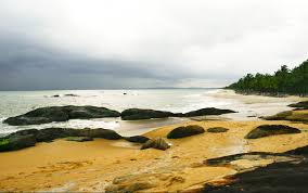
Kannur Beach is a group of five beaches on the western side of Kannur city in Kerala province of India. They are
  1. Payyambalam Beach
  2. Meenkunnu Beach
  3. Adikadalayi Beach
  4. Baby Beach
  5. Thayyil Beach

Kottiyoor

Kottiyoor is a village and the 23rd Wild Life Sanctuary of Kerala, situated in eastern hilly area of Kannur. Kottiyoor is located in the serene hills of Western Ghats. The ancient pilgrimage conducted here yearly, called 'Kottiyoor Vysakha Mahotsavam' attracts thousands of devotees every year. The Vavali river flows through Kottiyoor.

“Kottiyoor” comes from Koodi(Meeting) and Uuru(Precinct); the name comes from the pilgrimage in the region. The mythology says that this is the place where the holy trinity (Brahma, Vishnu and Shiva), Veerabhadra, Bhadrakali, Shiva Bhutaganas, revered Sages and other holy men came together to complete the Daksha Yaga. It is believed that Sati Devi immolated herself here. The etymology of most of the places on the way to Kottiyoor are also related to the mythology. Sati Devi's voyage to the “Yagashala” can be understood by the names of these area. The place where she desperately felt the need of Shiva and felt sad on his absence is called “Manathana”. The place where Sati Devi cried is now the name of a nearby village called “Kanneer char”. Another village nearby is “Aayothumchal”, this is where Sati felt tired and rested for some time. An ox was provided from a place on the way for the tired Devi to ride, this place is now known as “Kelakam”. There is a place called “Neendunokki” this is the place where Sati peeped at the distant 'Yaga shala' when she heard the noise emanating from there. The place where she had to pay taxation is called - “Chungakunnu”, where she walked slowly became “Mandhemcheri”. The place where she became extremely tired and fell down is “Murchilakadu”. “Mutherikavu” is a temple and the name of a village, it is where the sword which decapitated Daksha, was thrown by Veerabhadra . Stone hearths used for boiling milk came to be known as “Palukachiyamala”
Kottiyoor is declared as a wild life sanctuary by the Government of Kerala. It is the 23rd wild life sanctuary in Kerala. The total area of the zone is 3,037.98 hectares. It is in addition to the Aralam wild life sanctuary in Kannur District. Kottiyoor Wild Life Sanctuary is adjacent to the Bandipur National Park, a tiger reserve park in Karnataka border.
Kottiyoor is an exciting tourist spot for biologists, nature sight seers and mountaineering trekkers. Neendunokki, Palukachiyamala, Kelakam are all serene green places suitable for Eco tourism. The forest is serene, a large variety of birds and seasonal butterflies are deen here. Palukachipara's hilltop is a well known location for usual trekkers'.
Kottiyoor Utsavam, the yaga festival in Akkare Kottiyoor Shrine, is conducted yearly for 27 days commemorating the Daksha Yaga. The pilgrimage is on the west bank of Bavali river in a temporary shrine where the Swayambhu linga is present. During the time of pilgrimage the Ikkare Kottiyoor Temple will be closed. Thousands of pilgrims come to this place, the festival is in the rainy season of June–July.


KRISHNANATTAM

MAAHI

Mahe, situated on the west coast of Kerala is a former French colony in India. Geographically situated in Kerala, poilitically Mahe forms part of Pondicherry Union Territory. It lies south of Mahe River near where the river meets the sea. Mahe is famous as a brisk trade center of foreign liquor.

The history of Mahe is closely associated with a statue named Marianne, a proud symbol of French revolution. The freedom struggle of Mahe gathered momentum from this place. Hence, this place is now well maintained as a park in the name of Rabindranath Tagore.

The Headquarters office of Mahe administration is the Government House which is a fine example of the French architecture. There is a mini forest area at the back of the Government House. From this point, the Arabian Sea, the costline with golden sand, the Mayyazhi River and the Dharmadam island can be seen.

Other attractions include a tall flag mast, a lighthouse, remnants of a fort and the sunset. In addition to these, Mahe Boat house, 2 km from the Government house, in the Mahe River welcomes the visitors with speed boats, pedal boats and kayak boats. Some other places of interest are Thacholi Othenan’s Fort, Puzhakal Juma Masjid, St. Theresa Church, Sree Krishna Temple, St. George Fort, Puthalam Bhagavathi Temple and Sree Narayana Madam.

The Government Tourist Home near the Government House, the Zara Resort on the railway station road, the Arena Hotel near the Mahe Sports Club and the Municipal Tourist Home provide excellent accommodation.

St. Angelo Fort

The Dutch captured the fort from the Portuguese in 1663. They modernised the fort and built the bastions Hollandia, Zeelandia and Frieslandia that are the major features of the present structure. The original Portuguese fort was pulled down later. A painting of this fort and the fishing ferry behind it can be seen in the Rijksmuseum Amsterdam. The Dutch sold the fort to king Ali Raja of Arakkal in 1772. In 1790 the British seized it and used it as their chief military station in Malabar until 1947.
The fort is in the Cannanore Cantonment area. It is fairly well preserved as a protected monument under the Archaeological Survey of India. St Angelo's fort is a most important historical monument and a popular tourist attraction. Six Tourism Policeman are posted here for protection duty.
In 2015, thousands of cannonballs weighing several kilos were discovered from the Fort premises. The Archaeological Survey of India, which led the excavation, believes these were buried as part of military preparedness.


Arakkal Museum

The Arrakkal Museum is a museum dedicated to the Arakkal family, the only Muslim royal family in Kerala, south India. The museum is actually a section of the Arakkalkettu (Arakkal Palace). The durbar hall section of the palace has been converted into a museum by the Government of Kerala.

Arakkal family is the royal family which ruled Kannur for several centuaries. They had family relationship with Kolathiris, the rulers of the neighbouring Chirakkal kingdom. Arakkal family had trade relationship with Arabs and later with Europeans. The islands of Lakshadweep and Maldives were ruled by Arakkal family. The king of Arakkal kingdom was known as Arakkal Raja and the Queen was known as Arakkal Beevi.

Although renovated by the government, the Arakkalkettu is still owned by the Arakkal Family Trust and does not fall under the control of the country's archaeology department, the Archaeological Survey of India. The government had taken a keen interest in preserving the heritage of the Arakkal Family, which had played a prominent role in the history of Malabar. A nominal entry fee is charged by the Arakkal Family Trust from visitors to the museum.
It is a women ruling dynasty.
Although renovated by the government, the Arakkalkettu is still owned by the Arakkal Royal Trust and does not fall under the control of the country's archaeology department, the Archaeological Survey of India. The government had taken a keen interest in preserving the heritage of the Arakkal Family, which had played a prominent role in the history of Malabar. A nominal entry fee is charged by the Arakkal Royal Trust from visitors to the museum.


Dharmadam Island

Dharmadam Island in Kannur is an enchanting paradise – a beautiful, secluded spot with swaying coconut trees and wild bushes. Its verdant settings have given it the name Green Island. This little island is spread across just 5 acres but some time spent here is bound to refresh and rejuvenate you.

This isle is 100 meters from Dharmadam mainland, which is between Kannur and Thalasseri. It is formed as a result of a lateritic rock projection between two branches of the Anjarakkandy River and the Arabian Sea. During low tide, the sea recedes and you can walk across to the island. However, do not venture out on your own without a local guide, as the water can rise rapidly during high tide. Alternately, you can take a boat from the south end of Moidu Bridge which is close by on the Kannur-Thalasseri highway. If you are planning to picnic on the island, carry your own food as there are no restaurants here.

Although Green Island is uninhabited, it is a privately owned place and you need permission from the owners if you want to visit. The Kerala Government took over the island in 1998 to develop it for tourism. The best time to visit this island is between October and May
Dharmadam Island is a lush green tiny paradise! The island abounds in a variety of flora and many types of trees. The reddish-brown rocks that are scattered on the island are distinctive and add to the beauty of the place. There is one well on the island, and amazingly, the water from the well is not saline.

With its secluded charm, its luxuriant vegetation and the rippling waters of the Arabian Sea…Green Island has become a popular tourist haunt. The island is just 200 meters from the very popular Muzhuppilangad Beach, which is Asia’s longest drive-in beach.

Dharmadam means ‘the place of ethics’. In times past, Buddhist monks used to frequent this town. The town was also frequented by the Arabs and the Jews centuries ago. Today, the town still has an old-world charm thanks to its beach and the Green Island. It’s become very popular with honeymooners thanks to the romantic ambience!

When you are at Dharmadam you could pay a visit to Andalur Kaavu, a place of worship that is very popular with the locals. Kaavus are a quintessential part of Kerala Hindu tradition. It is a little preserved forest or grove dedicated to snakes. The serpents are worshipped at the Kaavu, which, with its dense vegetation, is a natural habitat for many varieties of snakes, which live in these groves undisturbed..

THEYYAM

Theyyam (Teyyam, Theyyattam ) (Malayalam:തെയ്യം) is a popular ritual form of worship of North Malabar in Kerala, India, predominant in the Kolathunadu area (consisting of present-day Kasargod, Kannur Districts, Mananthavady Taluk of Wayanad and Vadakara and Koyilandy Taluks of Kozhikode of Kerala) and also in Kodagu and Tulu nadu of Karnataka as a living cult with several thousand-year-old traditions, rituals and customs. The performers of Theyyam belong to the lower caste community, and have an important position in Theyyam.People of these districts consider Theyyam itself as a God and they seek blessings from this Theyyam. A similar custom is followed in the Tulu Nadu region of neighbouring Karnataka known as Bhuta Kola


Thursday, 21 July 2016

WAYANAD CLOSE TO NATURE

Wayanad district

ESCAPE tO tHE hEART oF nATURE

Wayanad District  CLOSE TO NATURE is a district in the north-east of Kerala state, India with headquarters at the town of Kalpetta. The district was formed on 1 November 1980 as the 12th district in Kerala by carving out areas from Kozhikode and Kannur districts. The district is 3.79% urbanised, with three municipal towns Kalpetta, Mananthavady and Sulthan Bathery.
Wayanad district is in the southern tip of the Deccan Plateau. Part of the Western Ghats is in the district. In the centre of the district hills are lower in height while the northern area has high hills.[citation needed] The eastern area is flat and open.
The region was known as Mayakshetra (Maya's land) in the earliest records. Mayakshetra evolved into Mayanad and finally to Wayanad. The Folk etymology of the word says it is a combination of Vayal (paddy field) and Naad (land), making it 'The Land of Paddy Fields'. There are many indigenous tribals in this area.
It is set high on the Western Ghats with altitudes ranging from 700 to 2100 m.
It is the least populous district in Kerala.
Unlike all other 13 districts of Kerala, in Wayanad district, there is no town or village named same as the district (i.e., there is no "Wayanad town").

According to archaeological evidence, the Wayanad forests have been inhabited for more than 3,000 years. Historians are of the view that human settlement existed in these parts for at least ten centuries before Christ. Much evidence of New Stone Age civilisation can be seen in the hills throughout the present day Wayanad district. Recorded history of this district is available from the 18th century. In ancient times, this land was ruled by the Rajas of the Veda tribe. In later days, Wayanad came under the rule of the Pazhassi Rajahs of Kottayam royal dynasty. When Hyder Ali becames the ruler of Mysore, he invaded Wayanad and brought it under his sway. In the days of Tipu, Wayanad was restored to the Kottayam royal dynasty. But Tipu handed over the entire Malabar region to the British, after the Sreerangapattanam truce, he made with them. This was followed by fierce and internecine encounters between the British and Kerala Varma Pazhassi Rajah of Kottayam. When the Rajah was driven to the wilderness of Wayanad, he organised the war-like Kurichiya tribals into a sort of people's militia and engaged the British in several guerrilla type encounters. In the end, the British could get only the dead body of the Rajah, who killed himself somewhere in the interior of the forest. Thus, Wayanad fell into the hands of the British and with it came a new turn in the Home of this area. The British authorities opened up the plateau for cultivation of tea and other cash crops. Roads were laid across the dangerous slopes of Wayanad, from Kozhikode and Thalassery. These roads were extended to the cities of Mysore and Ooty through Gudalur. Through the roads poured in settlers from all parts of Kerala and the virgin forest lands proved a veritable goldmine with incredible yields of cash crops. When the State of Kerala came into being in November 1956, Wayanad was part of Kannur district. Later, south Wayanad was added to Kozhikode district. In order to fulfil the aspirations of the people of Wayanad for development, north Wayanad and South Wayanad were carved out and joined together to form the present district of Wayanad. This district came into being on November 1, 1980 as the 12 district of Kerala

AND SO SOME IMPORTANT PLACES THAT YOU ALL SHOULD VISIT AT WAYANAD.


Muthanga Wildlife Sanctuary


1973 ൽ സ്ഥാപിതമായ മുത്തങ്ങ വന്യജീവി വിശുദ്ധമന്ദിരത്തിലെ തെക്ക് വടക്ക് തമിഴ്നാടിന്റെ മുതുമല കർണാടകത്തിലെ നാഗര്ഹോളെ ആൻഡ് ബന്ദിപ്പൂർ പ്രൊട്ടക്റ്റഡ് ഏരിയ നെറ്റ്വർക്ക് ലേക്ക് ഐലന്റ് ആണ്. ജൈവ വൈവിധ്യം സമ്പന്നമായ വിശുദ്ധമന്ദിരത്തിലെ നീലഗിരി ബയോസ്ഫിയർ റിസർവ് അവിഭാജ്യ ഭാഗമാണ്. മാനേജ്മെന്റ് ചുറ്റും വനം region.The സങ്കേതം താമസിക്കുന്ന ആദിവാസികളെ മറ്റുള്ളവരുടെ ജനറൽ ജീവിതശൈലി അർഹമായ പരിഗണനയും ശാസ്ത്രീയ സംരക്ഷണ ന് ഊന്നൽ അർത്ഥം ഒരു വലിയ ജനസംഖ്യ ഒരു പദ്ധതിയിലേയ്ക്ക് ആന സൈറ്റ് പ്രഖ്യാപിച്ചിട്ടുണ്ട്.

Elephants roam freely here and tigers are sighted occasionally. Various species of deer, monkeys, birds etc also live here. The Reserve is also home to a small population of tigers, a profusion of birds, butterflies and insects. The trees and plants in the sanctuary are typical of the south Indian moist deciduous forests and west coast semi evergreen forests. A drive along the road to Muthanga and further, offers chances to watch these roaming animals. Elephant rides are arranged by the Forest Department. 


Pookode Lake


Pookode Lake is a scenic freshwater lake in the Wayanad district in Kerala, South India. Pookode is a natural fresh water lake nestling amid evergreen forests and mountain slopes at an altitude of 770 meters above sea level. It is 15 km away from Kalpetta.
Panamaram, the rivulet which ultimately becomes Kabani River, originates from the Pookode lake. It is spread across an area of 8.5 hectares and with a maximum depth of 6.5 metres. Lying 3 km south of Vythiri town, the lake is one of the most popular tourist spots in Wayanad.
The lake has the shape of India's map. This perennial fresh water lake, nestled among wooded hills, is only one of its kinds in Kerala. Pethia pookodensis, is a species of cyprinid fish known to occur only in Pookode Lake. The lake has abundance of blue lotus and fresh water fishes. The forests surrounding the lake hold many wild animals, birds and flies.There are groups of Blue water lily flowers scattered here and there in the lake.
The lake is under the South Wayanad forest division and run by District Tourism promotion council. Boating facilities, children's park, handicrafts and spices emporium and fresh water aquarium are among the tourist attractions here.


PAKSHI PATHALAM

Pakshi Pathalam Cave is a must-visit for those of you who are bird lovers – the birds that live on trees, we mean! The ideal spot for an ornithologist, Pakshi Pathalam Cave literally means ‘home of birds’. Located 1740 meters above sea level, this bird-watchers’ paradise nestles cozily in the Brahmagiri hills at Thirunelli in Kerala. Of course, as the name suggests, Pakshi Pathalam Cave, the caves here are famous for rare birds such as the ‘edible nest swift’ that make saliva nests. The forests here are also natural habitats for elephants and deers.

Pakshi Pathalam Cave is 16 kilometers (to and fro) and the route goes through enchanting wild forest. The deep rock caves, formed among the thick blocks of rocks at the northern top end of the Brahmagiri, are the abode of various birds and wild beasts.

Pakshi Pathalam Cave proves to be a challenging spot for any adventure hungry tourist. Trekkers will find several trekking trails. Permission has to be sought from the Forest Department and they provide the necessary facilities for trekkers.

Pakshi Pathalam Cave is a huge black granite hill which makes it a major attraction for tourists. The unusual species of birds found here is another reason why this place attracts visitors from all over.


BANASURA DAM

Another tourist attraction of Kalpetta is Banasura Sagar dam. It is the largest earth dam in India and the second largest of its kind in Asia. The dam is made up of massive stacks of stones and boulders.

Situated about 15 km from Kalpetta, the dam holds a large expanse of water and its picturesque beauty is enhanced by the chain of mountains seen on the backdrop.  It is constructed in the Banasura Lake and the nearby mountains are known as Banasura Hills. Legends say that the Asura king of Banasura, (the son of King Mahabali, who is believed to visit Kerala during every Onam festival) undertook a severe penance on the top of these hills and thus it was named after him.  The scenic mountains beckon adventure tourists and the dam site is an ideal starting point for trekking.

During monsoon, visitors may also be able to see small islands in the dam’s reservoir. They are formed while the flooded reservoir submerges the surrounding areas too.  The vast expanse of the crystal clear water of the dam dotted with small islands is a photographer’s delight.
ഒരു അണക്കെട്ടും കനാൽ അടങ്ങുന്ന ബാണാസുര സാഗർ ഡാം ഇന്ത്യൻ ബാണാസുര സാഗർ പദ്ധതിയുടെ ഭാഗമായി ഓപ്പറേറ്റിങ് തുടങ്ങി. . ജല ദൌർലഭ്യം ഉണ്ടെങ്കിൽ അത് കക്കയം ജലവൈദ്യുത പദ്ധതി പിന്തുണച്ചപ്പോൾ ജലസേചനത്തിനായി സംഭാവന വേനൽക്കാലത്ത് ജനങ്ങളുടെ വെള്ളം ആവശ്യകതകൾ കുടിവെള്ള ലക്ഷ്യം

SOOJIPARA WATERFALLS


Soojipara is one of the beautiful places in Wayanad. The water falls from 100ft to 300ft heights is the uniqueness. To reach the waterfall, one has to trek down 2 km approximately over steep rocks. Another attraction of the place is the tree top huts which will give a unique view of the valley of the western ghats. Largely un-noticed and secluded in location, Sojjipara waterfalls form a spectacular attraction near Meppady. The flowing water forms 3 tiers during its course and pours down in the form of Meenmutty, Kanthanpara and Sojjipara falls. These falls cascade from a height of 100 to 300 ft. and lead to the formation of a pool which feeds into the mouth of Chaliyar River. Sojjipara refers to Needle Rocks and the falls are called so because they fall from a narrow opening. Tourists must trek downhill for a distance of 2 km and must cross vast tea plantation areas to reach the falls. Water rafting, swimming and viewing from tree-top huts are common activities amongst visitors at Sojjipara waterfalls.


EDACAL CAVE


 WikiMiniAtlas
 / 11.6246694; 76.2358000 / 11.6246694; 76.235are two natural caves at a remote location at Edakkal, 25 km from Kalpetta in the Wayanad district of Kerala in India's Western Ghats. They lie 1,200 metres above sea level on Ambukutty Mala, beside an ancient trade route connecting the high mountains of Mysore to the ports of the Malabar coast. Inside the caves are pictorial writings believed to date to at least 6,000 BC, from the Neolithic man, indicating the presence of a prehistoric civilization or settlement in this region. The Stone Age carvings of Edakkal are rare and are the only known examples from south India. The popular kannada movie edakallu guddada mele was set in the backdrop of this location 

These are not technically caves, but rather a cleft or rift approximately 96 feet (29 m) by 22 feet (6.7 m), a 30-foot-deep (9.1 m) fissure caused by a piece of rock splitting away from the main body. On one side of the cleft is a rock weighing several tons that covers the cleft to form the 'roof' of the cave. The carvings are of human and animal figures, tools used by humans and of symbols yet to be deciphered, suggesting the presence of a prehistoric settlement.
The petroglyphs inside the cave are of at least three types. The oldest may date back to over 8,000 years. Evidences suggest that the Edakkal caves were inhabited several times at different points in history.
The caves were discovered by Fred Fawcett, a police official of the erstwhile Malabar state in 1890 who immediately recognised their anthropological and historical importance. He wrote an article about them, attracting the attention of scholars.


THIRUNELLI TEMPLE
ITS REALLY MIND REFRESHING FACT WHILE VISITING THERE , SUCH A FABOLUS PLACE .
Thirunelli Temple (also Tirunelli) is an ancient temple dedicated to Lord Maha Vishnu on the side of Brahmagiri hill in Kerala. The temple is at an altitude of about 900m in north Wayanad in a valley surrounded by mountains and beautiful forests. It is 32 km away from Manathavady

No proper records of the exact dates of establishment of temple exist, though it is beyond dispute, that Thirunelli was once an important town and pilgrim center in the middle of an inaccessible jungle valley surrounded by mountains on four sides . There exists documentary proof that Thirunelli at the time of Tamil Chera king Bhaskara Ravi Varma I (962–1019 CE) was an important town and pilgrim center in South India. In the dense jungles surrounding temple, the ruins of two ancient villages can be found. Noted historian V. R. Parameswaran Pillai in his book Thirunelli Documents states that this temple was once an integral part of the early recorded history of Kerala.

The name Thirunelli derives from the nelli, the Tamil/Malayalam word for Indian gooseberry of the Amla tree. Veda vyasa wrote the 18 existing Puranas. The Matsya Purana, Skanda Purana, Narasimha Purana, Padma Purana, and many other Puranas and Hindu texts mention the beautiful Vishnu temple as being built by Lord Brahma, located in the picturesque Sahya valley, deep in the middle of forest of unmatchable beauty, and in these texts, it is referred to as "Sahyamalaka Kshetra."[1] According to tradition, Lord Brahma was traveling round the Universe on his hamsa, when he became attracted by the beauty of the area now known as Brahmagiri Hill. Descending on that spot, Brahma noticed an idol, set in an Amla tree. Brahma recognized the idol as Lord Vishnu Himself and the place as Vaikuntha (Vishnuloka) itself. With the help of the Devas, Brahma installed the idol and called it Sahyamalak Kshetra. At Brahma’s request Vishnu promised that the waters of the area would wash away all sins. (Thus, the spring and river near the temple is called Papanasini: “washes away all sins”).


 CHEMBRA PEAK

Chembra peak is situated near Meppady town and it is about 17 km from Kalpetta. It is the tallest peak in the region and a trek to the 6890 ft (2100 m above MSL ) peak is a challenge that is difficult to resist for  an adventure tourist.

Journey and the Ambience
Prior permission from Forest Range Office at Meppadi is needed for the trek as it is part of the Meppadi Forest Range. A drive from Meppadi to the foothill of the peak is breathtaking and you can feel the cool wind and the lush greenery of tea estates on both sides of the road rejuvenating your spirits. You can see a three-storied forest watch tower on the foothill of the peak and a three kilometre trek from the foothill is at the same time tiring and exciting.

A heart-shaped crystal perennial lake fed by natural springs can be seen at the middle of your journey. Even if it is scorching summer, the lake brims with water and helps you quench your thirst.

It is said that during the British era, British planters came here to play golf in the evenings and they constructed a stable for their horses and a rest house in the area. The relics of the rest house can be seen here even now.

View from Chembra Peak
Once you reach the top of Chembra peak, you will be astounded by the view that the place offers. With the varying shades of the virgin shola forests on both sides, you may feel a heavenly bliss that only the pristine nature can bestow upon human beings.  From this vantage point, the tourists can observe the mist clad peaks of Nilgiri ranges which include the Nilambur forests of Malappuram district. Apart from this, the town of Kalpetta and most parts of Wayanad district too are visible. The varying topography of the district which includes hills, rocks and valleys can be enjoyed the most from Chembra peak and you can also observe the silver linings of streams among the thick greenery. There is also a picturesque lake atop the hills which is another tourist attraction.

Govt initiatives
An ecotourism project is on the anvil for this area and the District tourism Promotion Council organises treks to this area. Trekking to the top of the hill takes almost a day and the DTPC arranges such trekking packages. Guides, trekking and camping apparatus etc. will be provided by DTPC and their packages also include one or two-day stay at temporary camps at Chembra.


Here its all about the wayanad district of kerala which fully refresh our minds , like this a travel through these will be really a great fell for our busy life . and one more thing while saying about wayanad we cannot forget WAYANAD CHURAM.


KOZHIKODE - THE REAL TASTE OF HALWA


Kozhikode


 Calicut ,  THE REAL TASTE OF HALWA  is a city in the state of Kerala in southern India on the Malabar Coast  The city lies about 380 kilometres (236 mi) north of the state capital Thiruvananthapuram .


During classical antiquity and the Middle Ages, Kozhikode was dubbed the "City of Spices" for its role as the major trading point ofeastern spices.] It was the capital of an independent kingdom ruled by the Samoothiris (Zamorins) in the Middle Ages and later of the erstwhile Malabar District under British rule. Arab merchants traded with the region as early as 7th century, and Portuguese explorer Vasco da Gama landed at Kozhikode on 20 May 1498, thus opening a trade route between Europe and Malabar. A Portuguese factory and fort was intact in Kozhikode for short period (1511–1525, until the Fall of Calicut), the English landed in 1615 (constructing a trading post in 1665), followed by the French (1698) and the Dutch (1752). In 1765, Mysore captured Kozhikode as part of its occupation of the Malabar Coast. Kozhikode, once a famous cotton-weaving centre, gave its name to theCalico cloth.
On 7 June 2012, Kozhikode was given the tag of "City of Sculptures" (Shilpa Nagaram) because of the various architectural sculptures located in various parts of the city. In May 2015, a food programme called Operation Sulaimani was introduced to help people who cannot afford a meal to have food with dignity.
According to data compiled by economics research firm Indicus Analytics on residences, earnings and investments, Kozhikode ranked as the second best city in India to reside in. It was ranked eleventh among Tier-II Indian cities in job creation by a study conducted by ASSOCHAM in 2007. Kozhikode city continues to be a centre of flourishing domestic and international trade. Its contribution to all round development of the district in trade, commerce and economic development over the years is spectacular. Kozhikode city is the marketing centre for commodities like pepper, coconut, coffee, rubber, lemon grass oil etc., produced in Kozhikode and the neighbouring districts of Wayanad, Malappuram and Kannur.

Kozhikode Beach


Kozhikode Beach is a beach on the western side of Kozhikode, situated on the Malabar Coast of India. The beach is accessible through four road overbridges in the city. The beach has paved stones and illumination. There is one Lions Park for the children and an acquarium. Kozhikode beach has always been a prominent place for conducting public meetings. The beach road was renamed 'Gandhi Road' in 1934 after Gandhi visited Calicut in 1934.


Kappad

Kappad, or Kappakadavu locally, is a famous beach near Kozhikode (Calicut), India, where the Portuguese explorer Vasco Da Gama landed on 20 May 1498. His voyage established the sea route from Europe to India. This established a permanent route from Europe to India. This heralded the arrival and permanent presence of various European merchant companies, leading to eventual domination and rule by the East India Company and later the period of British colonial rule.

VASCODE GAMA


Kallai (or Kallayi) is a small town on the banks of Kallai River which links with the Chaliyar river on the south by a man-made canal. It is in the Kozhikode district of Kerala in south India and is noted for timber trading.
During the late 19th century early 20th centuries, the Chaliyar River was extensively used as a waterway for carrying timber from the forest areas in and around Nilambur to the various mills in Kallai near Kozhikode (Calicut). Rafts made of logs were taken downstream during the monsoon season to Kallai, where these were sawn to size in the timber mills dotting the banks of the river.
During this period, Kallai was one of the most important centers in the world for the timber business. The place was noted for woods of superlative strength and durability like teakrosewood etc. Towards the second half of the 20th century, the activity declined drastically as tree felling was banned or strictly controlled with a view to stop deforestation. Many mills still operate in Kallai, though with far less output. Many have now closed down.
Kallayi Road starts from Palayam junction in the very heart of old Kozhikode. The first junction towards the south is Pushpa Junction which connects to Mankavu on the east and Kuttichira Beach on the west. The road continues to the south with landmarks like Paico Bookstall, Marzook College and the Kallayi Library. Panniyankara junction has a unique colonial building built in 1902 and called Princess of Wales Dispensary which is now converted into a homeo clinic. Panniyankara police station stands opposite to this clinic. Kannanchery, Nallalam and Areekkad are the next towns in the Kallayi Road. The SAIL-SCL steel factory and VKC Hawaii and the major industries in this area.


Peruvannamuzhi

Peruvannamuzhi or Peruvannamoozhy is a village in Chakkittapara Panchayath Kozhikode districtKerala, The main attraction of Peruvannamuzhi is its natural Splendor, a calm and quiet land nestled in the Western Ghats. Kuttiyadi Irrigation Project Dam is situated in Peruvannamuzhi. Peruvannamuzhi is known for tourism, wildlife and research on spice crops.
There is a reservoir with facilities for boating, and nature reserves. The reservoir supplies irrigation water to Kozhikode,Malapuram and Kannur. Other attractions include a crocodile farm and gardens. Peruvannamuzhi is rich in bird life and over 90 species of birds have been recorded at the Experimental Farm of Indian Institute of Spices Research.


Thusharagiri Falls


Thusharigiri Falls (Malayalamതുഷാരഗിരി വെള്ളച്ചാട്ടം) is a waterfall located in Kozhikode district in the Indian state ofKerala.
Two streams originating from the Western Ghats meet here to form the Chalippuzha River. The river diverges into three waterfalls creating a snowy spray, which gives the name, 'Thusharagiri'. The word Thusharagiri means the snow-capped mountain. Of the three, the highest waterfall is the Thenpara that falls from an altitude of 75 metres (246 ft). 
Thusharagiri offers endless scope for trekking, rock climbing and wild life sanctuary visits. It is around 50 kilometres (31 mi) from Kozhikode. The nearest town Kodancherry is around 11 kilometres (6.8 mi) from Thusharagiri. The other main towns situated here are Thiruvambadywhich is 18 km away and Thamarassery which is 17 km away. One has to purchase all necessary things for trekking from here.


KAKKAYAM VALLEY

The Kakkayam dam- Kakkayam Valley- Kariyathan Para, situated in Calicut district, 45-50kms away from the town and its noisy environment, offers the tourists not only a reservoir and its beauty but also a fantastic chance to enjoy the trekking and the scenic beauty of evergreen forest and grasslands. The main thing about this wonderful natural gift  is that, this place is still untouched by the tourists crowd and is not at all there in the tourist map of Kerala.


Sarovaram Bio Park

Sarovaram (also known as Sarovaram Bio Park) is an eco-friendly development near Kottooly in Kozhikode city in India. The park is situated adjacent to Canoly Canal. The project has been developed with an eco-friendly theme and is located in an ecosystem consisting of wetlands and mangrove forests containing bird habitats.


KOZHIKKODAN HALWA....


KOZHIKODAN HALWA .......


KOZHIKODAN BIRIYANIIIIIII.......


VASCODE GAMAAA........


BEACH......


MIND BLOWING.........TRAETSSS.............